Posts

Spreading My Own Wings
Image
            I had a good mix and variety of things to do my last week here. More Dusky island maintenance was a good part of it, but I also got out to see some more of the salmon run, spent half a day at Sheridan Glacier photographing some recently dislodged ice chunks and seeing the transition to fall, and taking one last trip out to the Motus tower we set up this spring. With a lot of rain recently (close to 50 inches in August), I was in the office and had the chance to test, and pass, my Dusky knowledge on the Washington Department of Fish and Game Southwest Canada Goose Test. It is a test that all hunters must pass that hunt in Southwest Washington to help with the identification of Duskies and other subspecies while hunting. I was also able to indulge in some historical photographs of the Copper River Delta and experience years of accelerated ecological succession in seconds.            After another awesome wee...

More Maintenance As Fall Closes In

Image
            With temperatures starting to reach freezing points on the North Slope, the great North American bird migration is already underway. Signs on the delta are prevalent: flocks of green-winged teal and northern shovelers line the banks of Alaganik Slough, yellowlegs call their call and try and outrace the airboat, trumpeter swan cygnets are fledged and turning their grey/juvenile color, and Duskies are starting to gain and regain flight over the rain-filled Copper River. Sunshine has been few and far between here in Cordova lately, but maintenance trips still provide some excitement. Recently, we had a bull moose run along side the airboat for a good while, providing for some good shots. Even with my camera in my drybag, I had enough time to get it out and get a few shots. Over the last few weeks, avian life has started to emerge again after a hiatus of birds secretly rearing their young. Many more are still to come out, but it's obvious the m...

Beginning Maintenance

Image
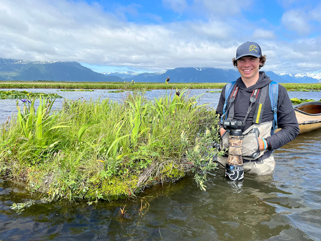
            With a storm pushing in later in the week last week, we left camp a day early to beat the weather and sift through some more nest island camera data. We maintained 73 islands before the storm, and will finish the rest in the coming weeks. Beginning with the furthest islands from camp, we fixed anchors, re-drilled island collars, landscaped completely bare islands, and even re-anchored islands that washed to shore. Most of the islands only needed landscaping, so the majority of the work was transplanting Sweetgale, and a few other species, from shore to the islands. Sometimes the Sweetgale digging got tough, so willows and even spruce trees became cover on some islands. On most islands, we would dig three or four clumps of Sweetgale, pile it into out boats, and bring it to the island.  Transporting Sweetgale to an island.  Group of molting geese with their fledging youngsters along the banks of Alaganik Slough.  We bumped this...

Veg Mapping Trip

Image
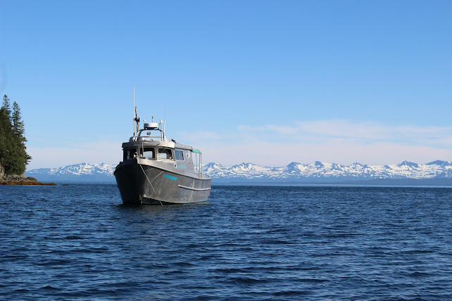
          Had a successful veg mapping trip last week. Was able to map a lot of cool plants, saw a ton of wildlife, and had tremendous weather the whole trip. We circled Knight Island in our four days of work, starting at the north end, then traveling down the east side to get south, and back up the west side towards the end of the trip. Knight Island is very steep in some spots, making it difficult to get out and walk at each of our plots, so we had several "boat obs" where plots could be called from boats using binoculars. Copper Bay, on the west side is surrounded by the four highest points on the island, reaching over 2500 ft in less than a mile traveling horizontally. Some plots were on cliffs, completely untraversable. The main reason for this mapping is to enhance the accuracy of a satellite that gives a comprehensive map of the vegetation of Prince William Sound. The satellite uses shapes and colors to determine what species are around, so by actual...