Veg Mapping Trip
Had a successful veg mapping trip last week. Was able to map a lot of cool plants, saw a ton of wildlife, and had tremendous weather the whole trip. We circled Knight Island in our four days of work, starting at the north end, then traveling down the east side to get south, and back up the west side towards the end of the trip. Knight Island is very steep in some spots, making it difficult to get out and walk at each of our plots, so we had several "boat obs" where plots could be called from boats using binoculars. Copper Bay, on the west side is surrounded by the four highest points on the island, reaching over 2500 ft in less than a mile traveling horizontally. Some plots were on cliffs, completely untraversable. The main reason for this mapping is to enhance the accuracy of a satellite that gives a comprehensive map of the vegetation of Prince William Sound. The satellite uses shapes and colors to determine what species are around, so by actually seeing the species, it confirms what the satellite mapped.
Sitka Spruce
Round-leaf (left) and Long-leaf (right) sundew, both carnivorous plants.
Skunk Cabbage
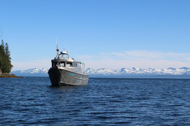
We take the smaller zodiac to shore to examine plots.
Non-edible and edible mushrooms were present in almost all of our shaded plots, below the canopy.
Devil's Club
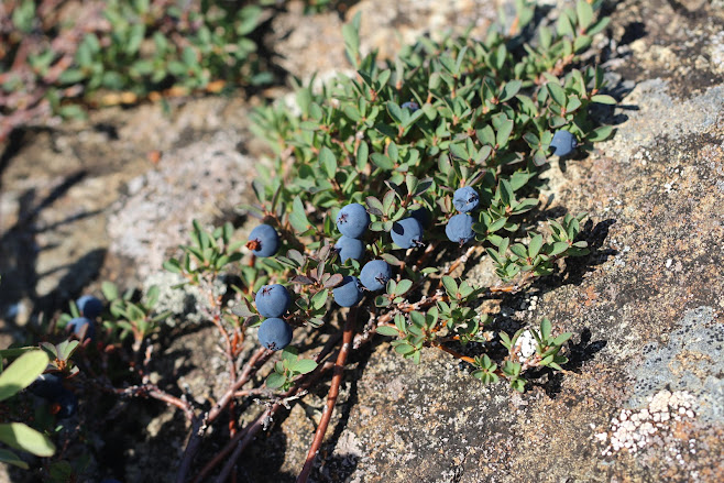
Copper Bush
Wall of water tumbling down a sparsely vegetated cliffside.
Kittiwake in up to its wings chasing bait fish in Herring Bay.
Fish Pass
Alpine meadows provided awesome views.
USFS "Tenacious" of Cordova and USFS "Dora Keen" of Whittier anchored at sunrise in Bay of Isles. We joined other Forest Service employees from Whittier, Alaska to conquer the vegetation of Knight Island.
The salmon were running on Knight Island's rivers and lakes, and I was able to see and photograph 6 black bears while we were anchored in Bay of Isles. We brought inflatable kayaks aboard the "Tenacious," so I was able to get close enough for a decent picture. I was even to able to explore some of the fish passes installed by the Forest Service in the late 70s and 80s. Saw plenty of eagles, sea otters, jellyfish, marbled murrelets, and even some Duskies flying over!
Non-edible and edible mushrooms were present in almost all of our shaded plots, below the canopy.
Moon Jelly
Solf Lake (freshwater), only 50 ft above sea level, but is 315 ft deep and has no saltwater intrusion.
Alpine meadows provided awesome views.


Comments
Post a Comment